Simple French retro map - Stockillustratie
A map of France, showing the main towns and cities and the principle roads. It also includes all the French regions on separate named layers, so any region can be selected and highlighted easily. This is not immediately visible as they are all the same colour currently. The major regions are also indicated by dotted borders. There are 33 layers in all, including separate layers for the slight texture on sea and land, so these can easily be removed if needed.

Bestel uw ingelijste foto direct en bekijk de diverse opties op Photos.com.
LICENTIE KOPEN
Alle royalty free licenties bieden wereldwijde gebruiksrechten en uitgebreide bescherming. Daarnaast zijn er eenvoudige tarieven met volumekortingen beschikbaar.
€ 335,00
EUR
Getty ImagesSimple French Retro Map, Stockfoto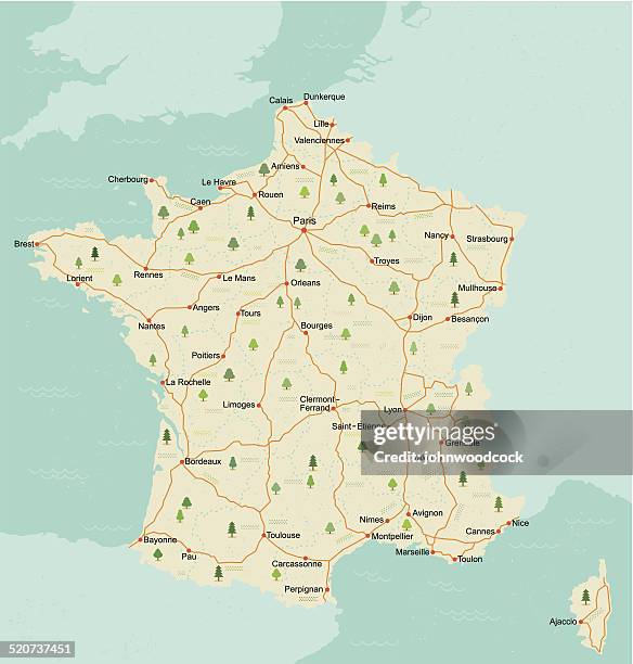 Download premium, authentieke Simple French retro map stockillustraties van Getty Images. Verken vergelijkbare stockillustraties met hoge resolutie in onze uitgebreide visuele catalogus.Product #:520737451
Download premium, authentieke Simple French retro map stockillustraties van Getty Images. Verken vergelijkbare stockillustraties met hoge resolutie in onze uitgebreide visuele catalogus.Product #:520737451€335€50
Getty Images
In stockGEGEVENS
Credits:
Creatief nr.:
520737451
Soort licentie:
Collectie:
DigitalVision Vectors
Max. bestandsgrootte:
3989 x 4182 px (26,32 x 27,59 cm) - 385 dpi - 3 MB
Datum van uploaden:
Release-informatie:
Model en property release
Categorieën:
- Kaart,
- Frankrijk,
- Aquitanië,
- Auvergne,
- Basse - Normandië,
- Bretagne - Frankrijk,
- Cartografie,
- Champagne-streek,
- Computergrafieken,
- Corsica,
- Elzas-Lotharingen,
- Franche-Comté,
- Franse cultuur,
- Haute-Normandie,
- Illustratie,
- Languedoc-Roussillon,
- Limousin - Frankrijk,
- Lotharingen,
- Midden-Frankrijk - Frankrijk,
- Midi-Pyrénées,
- Parijs - Frankrijk,
- Pays-de-la-Loire,
- Picardië,
- Poitou-Charentes,
- Provence-Alpes-Côte d'Azur,
- Rhône-Alpes,
- Vectorafbeelding,
- Île-de-France,